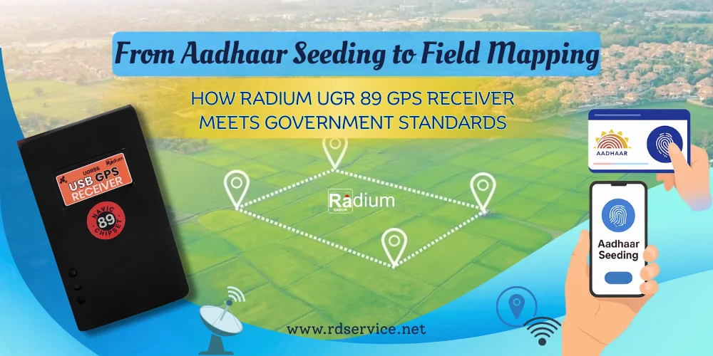
Nowadays, in the epoch of fast digitizing governance environment, accuracy and adherence to the rules are no longer a choice, they are a requirement. The significance of precise GPS technology has increased exponentially in relation to initiatives such as Aadhaar-enabled services or land and field mapping projects. Today we have theRadium UGR 89 GPS Receiver which is a high precision device that is designed to achieve the governmental protocols and e-governance initiatives within India.
It can be used in Aadhaar, property demarcation, agricultural land mapping, real-time tracking as well as others, which means it can offer the kind of reliability and accuracy demanded by central or individual state departments. This blog examines how this GPS device is not only compliant but in many cases surpasses the national agency standards established by the Indian government.
What is the Radium UGR 89 GPS Receiver?
The Radium UGR 89 is a plug-and-play USB GPS receiver that provides highly accurate geolocation data. It is compact, rugged, and engineered specifically for high-demand environments—making it ideal for fieldwork in both urban and rural India.
Some of its key highlights include:
-
High-sensitivity GPS chipset
-
Real-time location accuracy within 2.5 meters
-
USB interface for easy desktop/laptop integration
-
Compatible with GIS software
-
Government-standard compliant
Government Use Cases: Why Accuracy Matters
Let’s break down how the UGR 89 aligns with specific government use cases:
1. Aadhaar Seeding & e-KYC Location Validation
The Unique Identification Authority of India (UIDAI) requires location data to be captured during certain Aadhaar-related services. With the Radium UGR 89, GPS coordinates taken during Aadhaar seeding or eKYC can be accurately verified.
This helps in:
-
Tracking the location of authentication points
-
Geo-tagging Aadhaar enrollment and update centers
-
Reducing chances of location spoofing
2. Land & Property Mapping (PM-KISAN, PMAY, SVAMITVA)
Programs like PM-KISAN, SVAMITVA, and PM Awas Yojana (PMAY) need GPS-enabled devices for land verification, boundary mapping, and asset tracking.
The UGR 89 supports these by:
-
Providing real-time GPS coordinates with accuracy within 3 meters
-
Allowing data export to GIS platforms for mapping and analysis
-
Working well even in remote or low-network areas
3. Agricultural Field Surveys
State governments and agricultural departments require accurate field data for subsidy schemes, soil health cards, and fertilizer distribution.
The Radium UGR 89:
-
Helps verify plot sizes accurately
-
Supports location-tagged photos as evidence
-
Works with Android or desktop data entry apps
4. Vehicle Tracking & Attendance
Used by local bodies and municipal corporations for waste management, school bus tracking, and staff attendance, the UGR 89 offers:
-
Live GPS tracking with frequent updates
-
Geo-fencing features when paired with compatible software
-
Secure, tamper-proof data logging
Compliance with Government Standards
The Radium UGR 89 is fully compliant with protocols laid out by several Indian government bodies:
|
Compliance Standard |
Description |
|
GAGAN Compatibility |
Works with Indian SBAS system for enhanced accuracy |
|
STQC/UIDAI Guidelines |
Meets eKYC geotagging and Aadhaar Seva Kendra needs |
|
PM Fasal Bima Yojana (PMFBY) |
Used in insured crop surveys and disaster assessment |
|
Bhuvan/ISRO GIS Tools |
Compatible with government GIS and mapping platforms |
Technical Specifications
Here’s a quick glance at the key specifications of the UGR 89 GPS Receiver:
|
Feature |
Specification |
|
Chipset |
U-Blox GNSS Receiver |
|
Accuracy |
< 2.5 meters CEP |
|
Interface |
USB 2.0 Plug & Play |
|
Operating System |
Windows/Linux/Android (via OTG) |
|
LED Indicator |
Power and Fix Status |
|
Cold Start Time |
30 seconds (typical) |
|
Hot Start Time |
< 1 second |
|
Waterproof Level |
IPX4 |
|
Power Consumption |
Low power design (< 40 mA) |
Integration with Software Tools
The UGR 89 can easily integrate with:
-
Google Earth
-
QGIS/ArcGIS
-
Bhuvan GIS (ISRO)
-
Survey of India Mapping Tools
-
Custom government apps for land digitization
It supports standard output formats like NMEA 0183, making it compatible with a wide range of applications and software.
Why Government Agencies Prefer UGR 89
✅ Field-Proven Accuracy: Real-world accuracy confirmed by government surveyors
✅ Sturdy Design: Works in rugged environments—dust, rain, or high temperatures
✅ Plug & Play: No software installation needed; starts capturing GPS data instantly
✅ Affordable & Scalable: Ideal for mass rollouts across states or departments
✅ Service & Support: Free installation support from radium team.
The Radium UGR 89 is more able to support the signal multipath interference compared to older GPS receivers mainly because of developed technologies associated with its chipset, support of two GNSS + NaviC, and the latest signal processing methodologies.
Dual-Constellation Support for Redundancy: The UGR 89 obtains data of both the global GNSS (including GPS, GLONASS, Galileo, and BeiDou) and India NaviC constellation, and it can make use of a much larger number of them. This visibility enhancement of satellites enables the receiver to check-correspond all the incoming signals and choose the lessised direct routes, and the receiver reduces the effect of the reflected (multipath) signals which can easily mislead its calculations of the position.
Advanced Signal Processing: The current generation GPS chipsets like the ones probably in the UGR 89 have advance algorithms that assist in the detection and correction of multipath signals. Such chipsets are able to make use of correlation peak analysis, in which only the first (and presumably direct) signal is chosen upon which to position, thus filtering out delayed reflected signals also typical of multipath interference.
Regional Optimization through NaviC: Due to the fact that NaviC targets the region around India, and operates on a stronger, S-band signal, it tends to operate at higher power, less reflected reception in urban areas or other problematic areas where multipath will be more intense. UGR 89 can also use these signals to make decisions on the position fix with higher quality by incorporating it with international GNSS data.
Greater Real-Time Correction: The UGR 89 is much more likely to be resolved with respect to multipath by virtue of the fact that it can combine a larger number of satellites and reference signals in the solution process and ignore or de-weight out suspect data in the system as a whole, thus enhancing integrity of location.
As compared to the older GPS receivers which might not have used multi-system tracking (significantly more intelligent) and other solutions, the Radium UGR 89 can be used effectively in more challenging environments including urban canyons (or areas) as well as large structures or Indian terrain, where multipath is a major problem.
To get specific technical detail about the particular algorithms or hardware improvements in UGR 89 comparing to previous models, click here to check. The description above assumes common methods applied in higher-end GNSS and NaviC-coupled multicomponent receivers of the type currently available in the commercial field product lines
Key Takeaways
The Radium UGR 89 GPS Receiver uses global as well as regional navigation to enhance its accuracy and the uptime it uses, particularly in India.
The field processes are enhanced with enhanced accuracy, flexibility in signal-challenged zones, regulatory acceptance, as well as a smooth real-time supervision.
Suitable government, commercial and emergency use case where assurance of location is critical, non-rebuttable and tamper-proof.
The Radium UGR 89 operating on both GNSS and NaviC is designed to allay reliability, security, and compliance on the next-generation field activities in India and the surrounding areas
NaviC provides extremely accurate location information within India and 1,500km surrounding India which is useful to the users in the regional or close vicinity of the country
As compared to the earlier models of GPS, used in the fields, the Radium UGR 89 has a number of promoted features and advances:
Dual GNSS and NaviC Support: An ability to utilize both internationally-based satellite navigation systems, such as GPS, GLONASS, or even Galileo, and the local NaviC network, which exists in India only. This increases the number of satellites that are visible thereby increasing the positioning accuracy and reliability, particularly in India and within the vicinity.
Enhanced Regional Precision: NaviC integration makes the device much more precise and stable particularly in use by the people operating in India which was a major shortfall in an older GPS pack which was not able to incorporate regional constellations as well.
Regulatory Compliance: The UGR 89 will meet the existing regulatory requirements in India as the Indian government encourages or requires government and critical infrastructure applications to incorporate indigenous navigation systems (NaviC). They could not have all of the compliance focus of previous models, such as the UGR 86.
Improved Startup and Tracking: The UGR 89 features a faster start-up and more consistent tracking with the help of multiple constellation satellite services. This will guarantee that field teams do not face large delays and there will also be increased availability of data which is a disadvantage of single-system devices.
Security and Tamper-Resistance: The dual-system support provides additional security and tamper-resistance of the location data which is valued especially in mission-critical and government applications.
Plug-and-Play & Broad Compatibility: The UGR 89 is also USB connected and has a plug and play capability but extends compatibility to new generation field hardware and software.
Field Durability: As in the earlier example, the UGR 89 is designed to work in Indian conditions (heat, humidity, long hours of continuous use), but better suited to even more endurance and more reliability in more varied environs.
Final Thoughts
The Radium UGR 89 GPS Receiver is more than just a location-capturing device—it’s a cornerstone in India’s digital governance framework. As departments and service providers migrate from manual mapping to GPS-based automation, the need for reliable, government-compliant devices is greater than ever.
From Aadhaar seeding to field-level mapping, the UGR 89 meets the challenge with its durable build, high accuracy, and wide compatibility. If you're a service provider, government contractor, or field surveyor looking for a dependable GPS solution, the Radium UGR 89 should be your go-to choice.
Need help with setup or integration?
Visit rdservice.net for drivers and installation support.